
BLOG

Catalyst Lakeland
Not everyone gets to say they created a realtime interactive 3D model of their hometown, but we can.
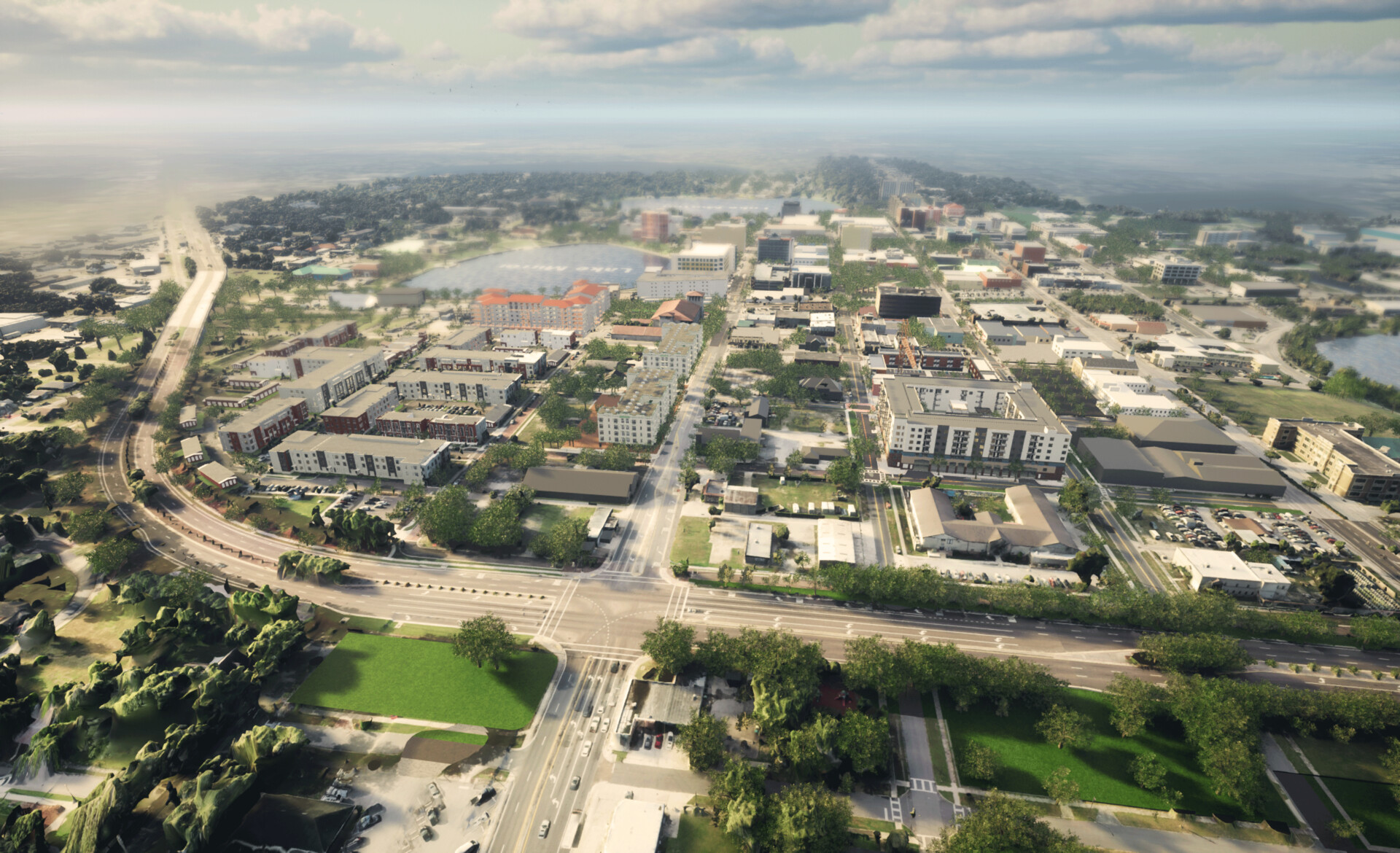
Working as Technical Lead at The Apiary Studios, Will English of Realistic Picture Group was responsible for overseeing technical implementation of the Catalyst Lakeland Digital Twin.
Using Reality Capture we created an accurate photogrammetry model of 4 square miles of Lakeland’s downtown core. From there Will and the team hand modeled important historical buildings and sites of interest using Maya and oversaw import and optimization of Revit models from the architecture team. We also used Houdini to generate optimized tiled background terrain from survey data.
The result is a photorealistic real-time interactive model of Lakeland, but not just Lakeland as it is now, rather this shows what Lakeland could look like if all the conceptual architectural designs are approved.
Catalyst is a powerful tool for enabling real estate developers, city officials, and the public to collaborate together on a vision for the future of Lakeland, Florida. It’s been a very interesting project to build.
The digital twin is live and ready to stream to your browser at https://catalystlakeland.com

Nautilus – Realtime Underwater Mapping and Immersion (RUMI)
Dive into the Depths with RUMI: Real-Time Underwater Mapping and Immersion Welcome to the world of deep-sea exploration with RUMI – Real-time Underwater Mapping and Immersion. This innovative project, in collaboration with Nautilus Ocean Exploration Trust, brings the...
Catalyst Lakeland
Not everyone gets to say they created a realtime interactive 3D model of their hometown, but we can. Working as Technical Lead at The Apiary Studios, Will English of Realistic Picture Group was responsible for overseeing technical implementation of the Catalyst...
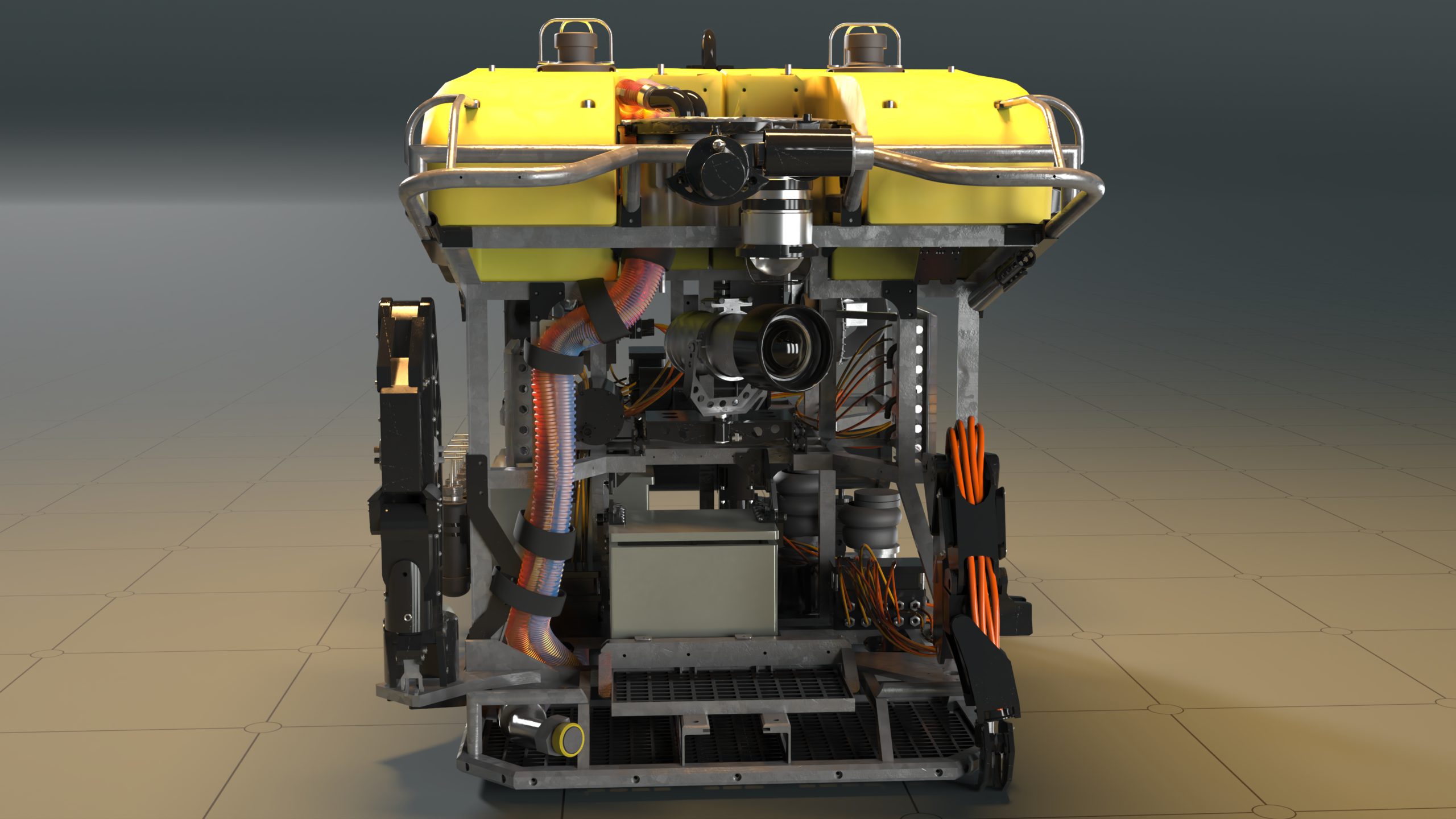
Nautilus – Deep Sea ROVs
We were contacted by Nautilus Ocean Exploration Trust to create renderings as part of their "Beyond the Wow" video series. The aim of these videos is to show kids who may be a aspiring undersea explorers and scientists just what is involved to make a dive...
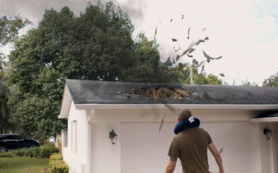
Roof destruction VFX shot
The Collection Media We wrapped up the year 2020 with an exciting, and somewhat quirky VFX collaboration with The Collection Media. When The Collection approached us they were wondering if we could help them create a flaming meteor and destroy a small residential...
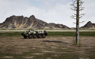
Realtime 3D Satellite Terrain
Manifold Analytics Manifold Analytics performs geo-spatial analytics and machine vision using satellite and aerial imagery. They use this data to gather valuable insights for their clients in defense, energy, and rail. Manifold reached out to us expressing interest in...
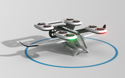
Altran: Urban Air Mobility
DPC Studio / Altran Technologies / Frog Design Altran Technologies’ “Project Viable” is an innovative effort to provide people all over the world with an “extended radius of life” through the use of vertical takeoff capable electric air taxis, or eVTOLs (Electric...